GRAND FORKS, ND (trfnews.i234.me) An interview with storm chaser Reed Timmer rolling through Grand Forks, North Dakota.
Tag: Storm
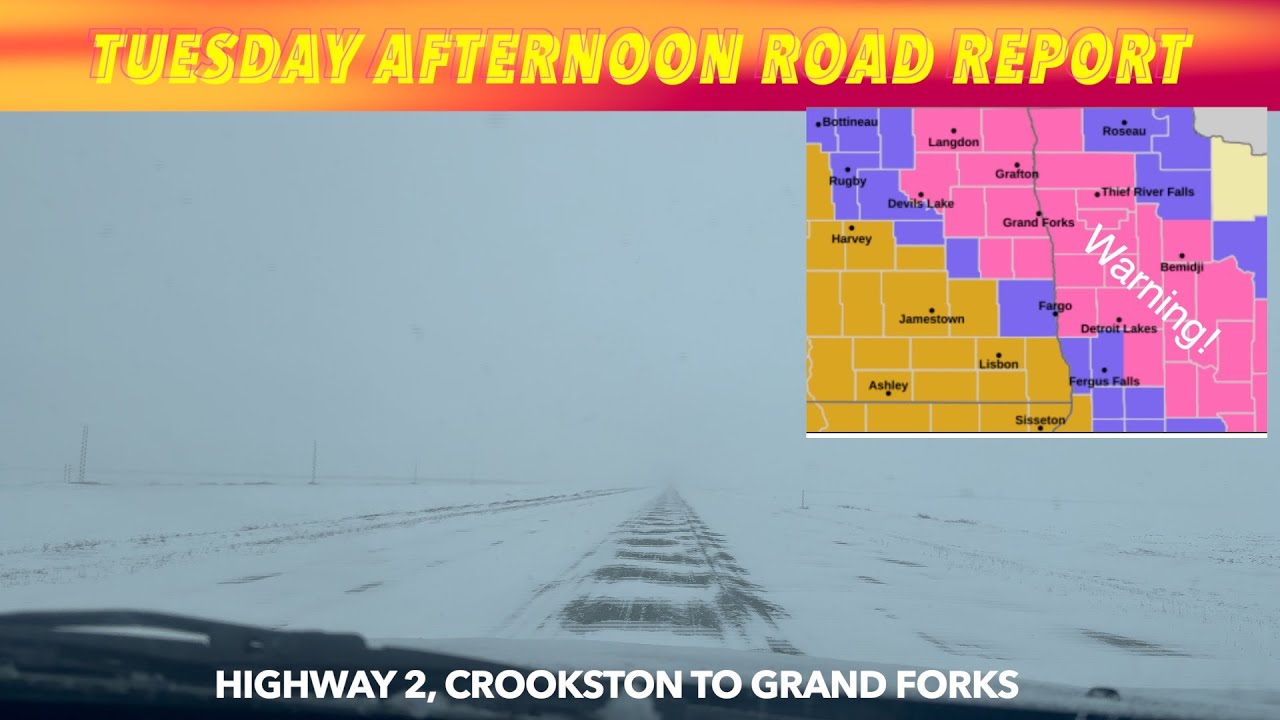
STORM WARNING: Tuesday Afternoon Road Report
Major Storm Damage Across Bemidji Area * Beltrami Co. Declares State of Emergency

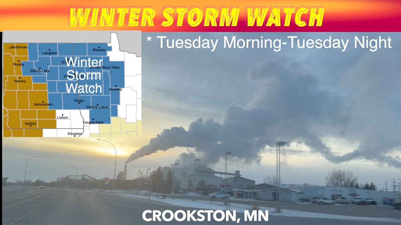
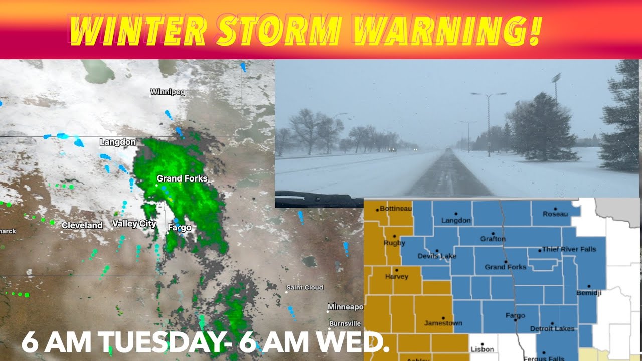
UPDATE: Tuesday Winter Storm Warning
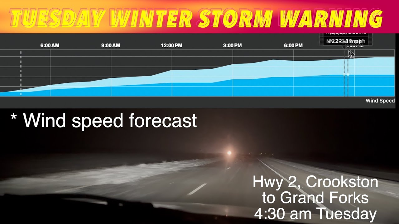
Winter Storm Warning!
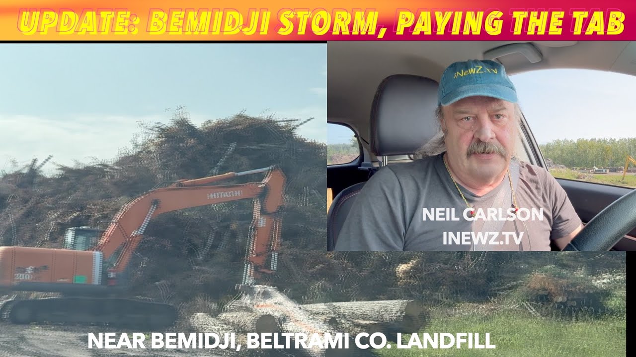
UPDATE: Bemidji Storm, Who’s Paying The Cleanup Tab
Storm Causes Freak Fires & Power Outage In Oklee, Minnesota

OKLEE, MN (trfnews.i234.me) Two vehicle fires and power outage after a storm blew through Oklee, Minnesota early Sunday morning.kind of a freak accident as that storm blew through Oakley, Minnesota over in Red Lake County early on this Sunday morning. Uh this from Red Lake County Sheriff Mitch Bernstein. A live power line blew over… Continue reading Storm Causes Freak Fires & Power Outage In Oklee, Minnesota
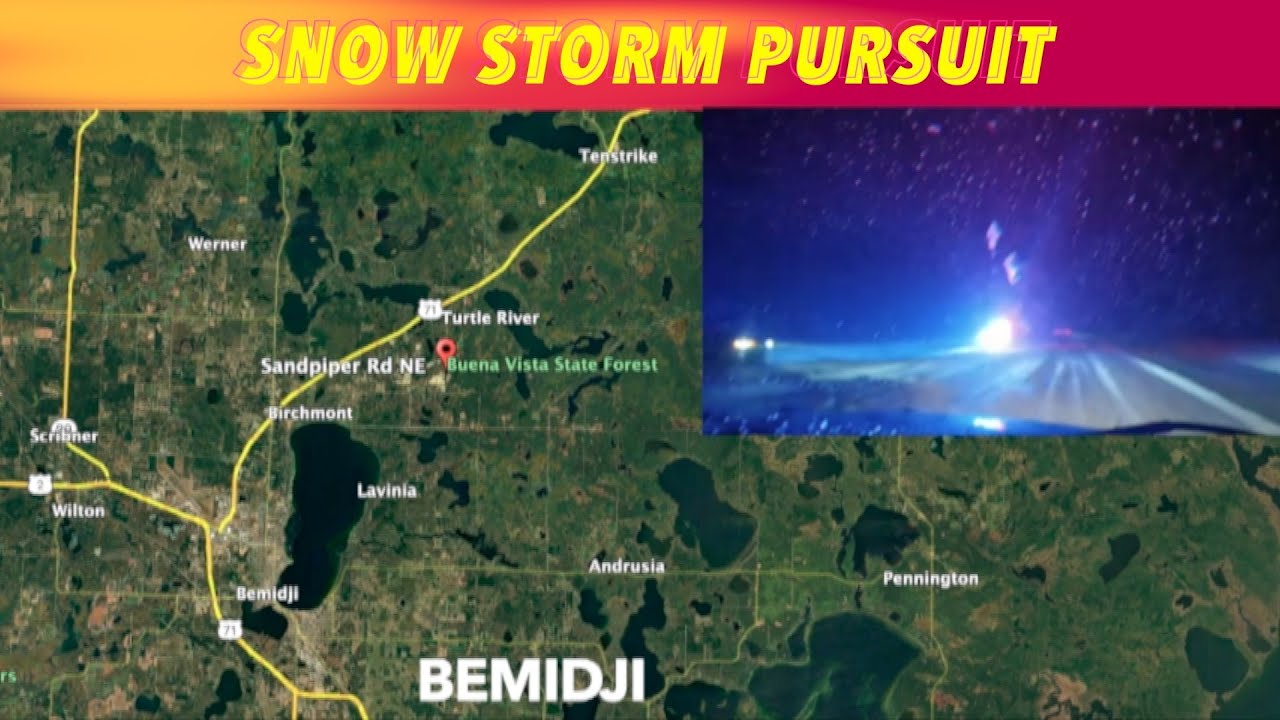
Bemidji Snowstorm Chase: Driver Charged
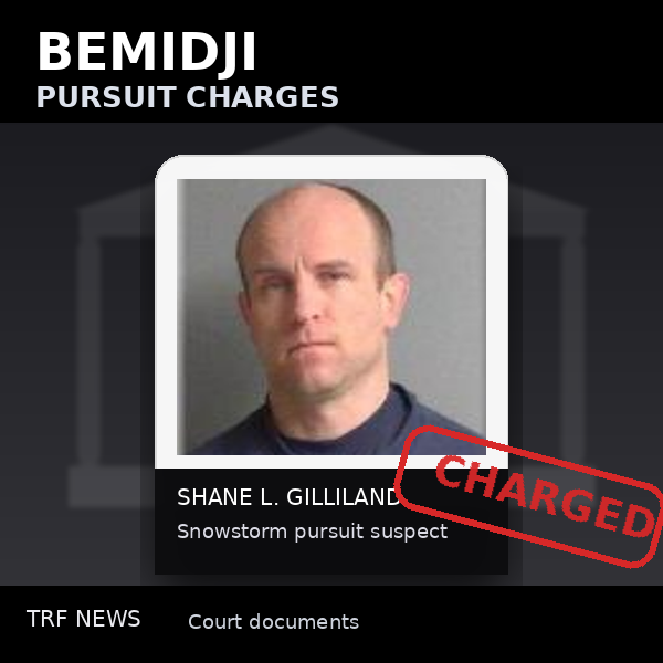
Bemidji, Minnesota (trfnews.i234.me) — A Bemidji man is now facing criminal charges after a reported pursuit during Tuesday night’s snowstorm. Shane L. Gilliland, of Bemidji, is charged in connection with the incident. Court records allege he fled a traffic stop and drove more than 10 miles before stopping at a home. What court records say… Continue reading Bemidji Snowstorm Chase: Driver Charged